Geotechnical measurements: Difference between revisions
From BAWiki
No edit summary |
|||
| Line 1: | Line 1: | ||
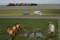
[[File: | [[File:01_Methoden_02.jpg|200px|thumb|right|Picture 1: Vibration measurements at the bank]]Geotechnical measurements (static, dynamic, [[Hydraulics|hydraulic]]) serve on the one hand to [[Monitoring|monitor]] earthworks and structures after completion or during new construction work. On the other hand, they are indispensable when designing building structures on the basis of the observation method, when numerical predictions for various stages of construction progress are compared with real behaviour. It is thus possible to optimize the on-going computing steps. | ||
== Geomechanical measurements == | == Geomechanical measurements == | ||
Revision as of 11:58, 20 May 2022

Geotechnical measurements (static, dynamic, hydraulic) serve on the one hand to monitor earthworks and structures after completion or during new construction work. On the other hand, they are indispensable when designing building structures on the basis of the observation method, when numerical predictions for various stages of construction progress are compared with real behaviour. It is thus possible to optimize the on-going computing steps.
Geomechanical measurements

Standard measurements include the loading tests on piles and anchors as stipulated in the standards. Measurements are also carried out at slopes, retaining structures and foundations for the preservation of evidence and when using the observational method. Measurements at structures, foundation elements, in the ground and on models can be useful for design in cases where neither theoretical principles nor practical experience is available to provide reliable, economic solutions for geotechnical problems in waterways engineering.
Measuring groundwater level and pressure

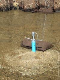
Geohydraulic measurements are needed both for ascertaining the existing groundwater conditions and for forecasting changes caused by work carried out in the federal waterways in the framework of planning approval procedures or hydrogeological expert opinions, for the conservation of groundwater evidence, for ascertaining groundwater pressure and current loads on concrete and earthwork structures or excavation pits, and for monitoring building structures.
Measuring groundwater level and pressure
Geodynamic measurements

Geodynamic measurements are used to ascertain the emission, propagation and impact of vibrations caused by construction work and operation at and on waterways. Vibrations in waterways are generated for example when installing sheet piling, during loosening and demolition blasting, during chiselling work, during surface and in-depth compaction of the ground, from propulsion systems of vessels, from vessel impact when mooring and from stationary systems such as pumps and machines, together with the flow forces, e.g. at locks.
Measuring the thickness of sheet piles
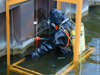
Non-destructive methods using ultrasound equipment are carried out to assess the stability and serviceability of sheet piling structures. The measuring results are used to estimate the residual service life of existing structures (stability) and to forecast the point in time of the first signs of rust perforation (serviceability).
back to: Geotechnical Engineering Methods
