NetCDF synoptic data at multiple locations: Difference between revisions
From BAWiki
imported>Lang Guenther (text filled in from German page. Partially translated into English) |
imported>Lang Guenther (→Version Discrete Sampling Geometry timeSeriesProfile: section on depth dependent data translated) |
||
| Line 41: | Line 41: | ||
==Data with Z-Dependence== | ==Data with Z-Dependence== | ||
Salinity typically depends on time, location and depth. In our case the z-coordinate reflects the center of water mass for the respective volume. Salinity is therefore a good example for a geophysical variable with z-dependence. | |||
float Mesh0_node_Salzgehalt_2d(nMesh0_data_time, nMesh0_layer_2d, nMesh0_node) ; | float Mesh0_node_Salzgehalt_2d(nMesh0_data_time, nMesh0_layer_2d, nMesh0_node) ; | ||
| Line 56: | Line 56: | ||
: :standard_name = "sea_water_salinity" ; | : :standard_name = "sea_water_salinity" ; | ||
Remarks: | |||
# Invalid data may be present (see ''_FillValue''). | |||
# | # Auxiliary variable (see ''ancillary_variables'') '''Mesh0_node_Gesamtwassertiefe_2d''' may be used during processing (data analysis and visualization) to neglect data for locations with very shallow water. | ||
# | # Salinity is synoptic and (in our case) an volume mean value (see ''cell_methods''). | ||
# | # Variable '''Mesh0_node_Wasservolumen_2d''' contains the relevant volume for volume mean values. | ||
# | # With additional help of '''Mesh0_node_Wasserflaeche_2d''' exact values for salt mass per area can be derived. | ||
# | # Label coordinate variable '''Mesh0_node_long_name''' can be used for selection of locations (see ''coordinates''). | ||
# | |||
==Data for several Fractions== | ==Data for several Fractions== | ||
Revision as of 12:17, 21 October 2016
Short Description
Synoptic data for multiple locations are described. A few examples for typical variables are shown.
Additional Descriptions
- NetCDF multiple locations: coordinates as well as coordinate transformation for multiple locations.
- NetCDF time coordinate: coordinate variable time.
- NetCDF vertical coordinate: time and space dependent vertical coordinate variable.
Version Discrete Sampling Geometry timeSeriesProfile
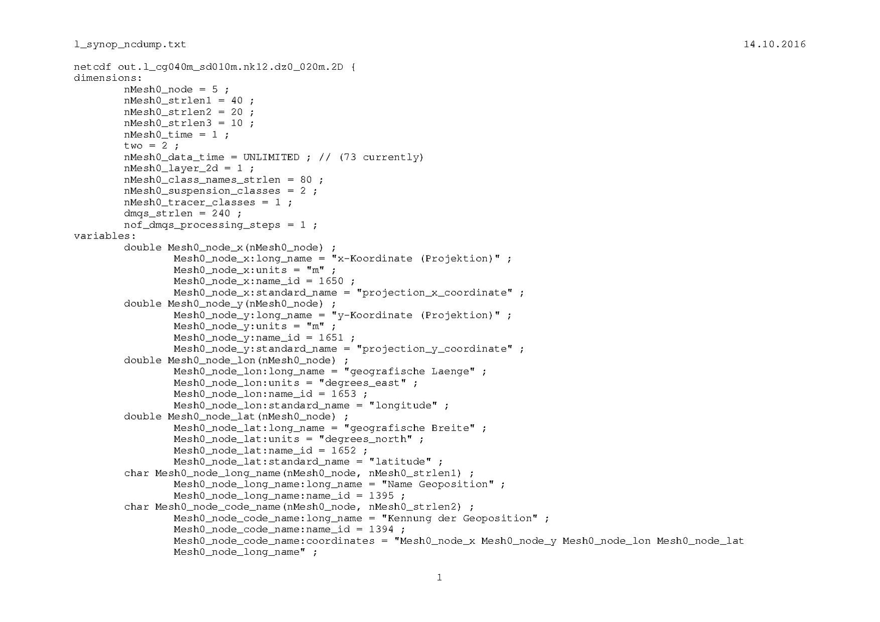
Data for several individual locations are stored in a netCDF file in accordance with the concept of a Discrete Sampling Geometry with featureType=timeSeriesProfile. An example (output from NCDUMP) for geometry as well as data is shown in  .
.
Data without Z-Dependence
Water level typically depends on time and location. But it is independent from the z-coordinate. Water level is therefore a good example for a geophysical variable without z-dependence.
float Mesh0_node_Wasserstand_2d(nMesh0_data_time, nMesh0_node) ;
- :long_name = "Wasserstand [ node ]" ;
- :units = "m" ;
- :name_id = 3 ;
- :_FillValue = 1.e+31f ;
- :ancillary_variables = "Mesh0_node_Gesamtwassertiefe_2d" ;
- :cell_measures = "area: Mesh0_node_Wasserflaeche_2d" ;
- :cell_methods = "nMesh0_data_time: point nMesh0_node: mean" ;
- :comment = "ancillary variables may be used ..." ;
- :coordinates = "Mesh0_node_lon Mesh0_node_lat Mesh0_node_x Mesh0_node_y Mesh0_node_long_name" ;
- :grid_mapping = "Mesh0_crs" ;
- :standard_name = "sea_surface_height" ;
Remarks:
- Invalid data may be present (see _FillValue).
- Auxiliary variable (see ancillary_variables) Mesh0_node_Gesamtwassertiefe_2d may be used during processing (data analysis and visualization) to neglect data for locations with very shallow water.
- Water level is synoptic and (in our case) an area mean value (see cell_methods).
- Variable Mesh0_node_Wasserflaeche_2d contains the relevant area for area mean values.
- Label coordinate variable Mesh0_node_long_name can be used for selection of locations (see coordinates).
Data with Z-Dependence
Salinity typically depends on time, location and depth. In our case the z-coordinate reflects the center of water mass for the respective volume. Salinity is therefore a good example for a geophysical variable with z-dependence.
float Mesh0_node_Salzgehalt_2d(nMesh0_data_time, nMesh0_layer_2d, nMesh0_node) ;
- :long_name = "Salzgehalt [ node ]" ;
- :units = "1e-3" ;
- :name_id = 5 ;
- :_FillValue = 1.e+31f ;
- :ancillary_variables = "Mesh0_node_Gesamtwassertiefe_2d" ;
- :cell_measures = "volume: Mesh0_node_Wasservolumen_2d area: Mesh0_node_Wasserflaeche_2d" ;
- :cell_methods = "nMesh0_data_time: point nMesh0_layer_2d: mean nMesh0_node: mean" ;
- :comment = "ancillary variables may be used ..." ;
- :coordinates = "Mesh0_node_lon Mesh0_node_lat Mesh0_node_x Mesh0_node_y Mesh0_node_z_node_2d Mesh0_node_long_name" ;
- :grid_mapping = "Mesh0_crs" ;
- :standard_name = "sea_water_salinity" ;
Remarks:
- Invalid data may be present (see _FillValue).
- Auxiliary variable (see ancillary_variables) Mesh0_node_Gesamtwassertiefe_2d may be used during processing (data analysis and visualization) to neglect data for locations with very shallow water.
- Salinity is synoptic and (in our case) an volume mean value (see cell_methods).
- Variable Mesh0_node_Wasservolumen_2d contains the relevant volume for volume mean values.
- With additional help of Mesh0_node_Wasserflaeche_2d exact values for salt mass per area can be derived.
- Label coordinate variable Mesh0_node_long_name can be used for selection of locations (see coordinates).
Data for several Fractions
Der über die Wassertiefe gemittelte Sschwebstoffgehalt ist von der Zeit und der Position abhängig. Eine Abhängigkeit von der z-Koordinate ist hier vorhanden, da in unserem Fall die z-Koordinate den Schwerpunkt des Wasserkörpers beschreibt. Zusätzlich kann der Schwebstoffgehalt für mehrere Schwebstoff-Fraktionen nMesh0_suspension_classes vorhanden sein. Daher dient der Schwebstoffgehalt als Beispiel für eine geophysikalische Variable mit mehreren Fraktionen.
float Mesh0_node_Schwebstoffgehalt_2d(nMesh0_data_time, nMesh0_suspension_classes, nMesh0_layer_2d, nMesh0_node) ;
- :long_name = "Schwebstoffgehalt [ node ]" ;
- :units = "kg m-3" ;
- :name_id = 7 ;
- :_FillValue = 1.e+31f ;
- :ancillary_variables = "Mesh0_node_Gesamtwassertiefe_2d" ;
- :cell_measures = "volume: Mesh0_node_Wasservolumen_2d area: Mesh0_node_Wasserflaeche_2d" ;
- :cell_methods = "nMesh0_data_time: point nMesh0_suspension_classes: point nMesh0_layer_2d: mean nMesh0_node: mean" ;
- :comment = "ancillary variables may be used ..." ;
- :coordinates = "Mesh0_node_lon Mesh0_node_lat Mesh0_node_x Mesh0_node_y Mesh0_node_z_node_2d Mesh0_node_long_name Mesh0_Schwebstoffklassen_2d" ;
- :grid_mapping = "Mesh0_crs" ;
- :standard_name = "concentration_of_suspended_matter_in_sea_water" ;
Anmerkungen:
- Es können ungültige Daten vorhanden sein (siehe _FillValue).
- Die Hilfsvariable (siehe ancillary_variables) Mesh0_node_Gesamtwassertiefe_2d kann bei der weiteren Verarbeitung (Analyse, Visualisierung) dazu verwendet werden, Orte mit sehr geringer Wasserbedeckung nicht auszuwerten.
- Der Schwebstoffgehalt ist für jede Fraktion ein (synoptischer) Augenblickswert und ein Volumen-Mittelwert (siehe cell_methods).
- In der Variable Mesh0_node_Wasservolumen_2d ist das für den Volumen-Mittelwert relevante Volumen enthalten.
- Mit zusätzlicher Hilfe von Mesh0_node_Wasserflaeche_2d kann in exakter Weise die Schwebstoffmasse/Fläche ermittelt werden.
- Die Label-Koordinatenvariable Mesh0_node_long_name kann zur Auswahl von Position(en) verwendet werden (siehe coordinates).
back to NetCDF
