NetCDF multiple locations: Difference between revisions
From BAWiki
imported>Lang Guenther (layout was simplified) |
imported>Lang Guenther (→Version Discrete Sampling Geometry timeSeriesProfile: list and description of variables added) |
||
| Line 8: | Line 8: | ||
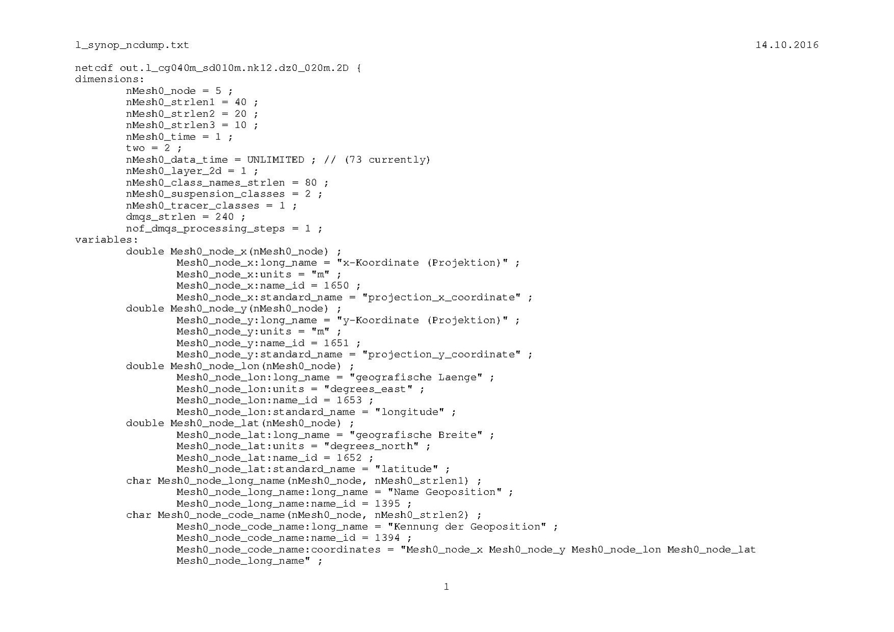
Data for several individual locations are stored in a netCDF file in accordance with the concept of a ''Discrete Sampling Geometry'' with '''featureType=timeSeriesProfile'''. An example (output from NCDUMP) for geometry as well as data is shown in [[File:L_synop_ncdump_2D.pdf]]. | Data for several individual locations are stored in a netCDF file in accordance with the concept of a ''Discrete Sampling Geometry'' with '''featureType=timeSeriesProfile'''. An example (output from NCDUMP) for geometry as well as data is shown in [[File:L_synop_ncdump_2D.pdf]]. | ||
Short list and description of some relevant variables used for individual locations: | |||
* '''Mesh0_node_x'''(nMesh0_node): x-coordinate; | |||
* '''Mesh0_node_y'''(nMesh0_node): y-coordinate; | |||
* '''Mesh0_node_lon'''(nMesh0_node): geographic longitude; | |||
* '''Mesh0_node_lat'''(nMesh0_node): geographic latitude; | |||
* '''Mesh0_node_long_name'''(nMesh0_node,nMesh0_strlen1): long name; | |||
* '''Mesh0_node_code_name'''(nMesh0_node,nMesh0_strlen2): short name; | |||
* '''Mesh0_node_short_name'''(nMesh0_node,nMesh0_strlen3): shorthand name; | |||
* '''Mesh0_node_id'''(nMesh0_node): identification number, e.g. with ''cf_role'' matching current ''featureType''; | |||
* '''Mesh0_crs''': scalar container variable with informations (contents of attributes) about the coordinate transformation used (relationship between local and geographical coordinates). | |||
=Version [[DATACONVERT]]= | =Version [[DATACONVERT]]= | ||
Revision as of 14:43, 20 October 2016
Introduction
The coordinate variables for multiple locations are described.
Version Discrete Sampling Geometry timeSeriesProfile
Data for several individual locations are stored in a netCDF file in accordance with the concept of a Discrete Sampling Geometry with featureType=timeSeriesProfile. An example (output from NCDUMP) for geometry as well as data is shown in  .
.
Short list and description of some relevant variables used for individual locations:
- Mesh0_node_x(nMesh0_node): x-coordinate;
- Mesh0_node_y(nMesh0_node): y-coordinate;
- Mesh0_node_lon(nMesh0_node): geographic longitude;
- Mesh0_node_lat(nMesh0_node): geographic latitude;
- Mesh0_node_long_name(nMesh0_node,nMesh0_strlen1): long name;
- Mesh0_node_code_name(nMesh0_node,nMesh0_strlen2): short name;
- Mesh0_node_short_name(nMesh0_node,nMesh0_strlen3): shorthand name;
- Mesh0_node_id(nMesh0_node): identification number, e.g. with cf_role matching current featureType;
- Mesh0_crs: scalar container variable with informations (contents of attributes) about the coordinate transformation used (relationship between local and geographical coordinates).
Version DATACONVERT
Dimensions
- nMesh0_node : Number of locations.
Local coordinates
double Mesh0_node_x(nMesh0_node) ;
- Mesh0_node_x:long_name = "x-coordinate (projection)" ;
- Mesh0_node_x:units = "m" ;
- Mesh0_node_x:name_id = 1650 ;
- Mesh0_node_x:standard_name = "projection_x_coordinate" ;
double Mesh0_node_y(nMesh0_node) ;
- Mesh0_node_y:long_name = "y-coordinate (projection)" ;
- Mesh0_node_y:units = "m" ;
- Mesh0_node_y:name_id = 1651 ;
- Mesh0_node_y:standard_name = "projection_y_coordinate" ;
Comment:
- "name_id" corresponds to the so-called PHYDEF-Code of variables which is used internally at BAW.
Geographic coordinates
double Mesh0_node_lon(nMesh0_node) ;
- Mesh0_node_lon:long_name = "geographic longitude" ;
- Mesh0_node_lon:units = "degrees_east" ;
- Mesh0_node_lon:name_id = 1653 ;
- Mesh0_node_lon:standard_name = "longitude" ;
double Mesh0_node_lat(nMesh0_node) ;
- Mesh0_node_lat:long_name = "geographic latitude" ;
- Mesh0_node_lat:units = "degrees_north" ;
- Mesh0_node_lat:name_id = 1652 ;
- Mesh0_node_lat:standard_name = "latitude" ;
Comment:
- "name_id" corresponds to the so-called PHYDEF-Code of variables which is used internally at BAW.
Coordinate Transformation
For details see NetCDF grid mapping variable.
Additional remarks
None.
back to NetCDF
