Validation studies Jade-Weser
From BAWiki
Models of the Jade-Weser-Estuary
Basic model Jade-Weser, version 1: Topography 2002
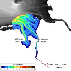
For the Jade-Weser-Estuary a model was built based on the mathematical models UNTRIM-SEDIMORPH to calculate hydrodynamics, salt and suspended matter transport. The model topography (Figure Topography Jade-Weser-Estuary)

represents year 2002. The spatial resolution is high enough to yield realistic results, but still allows for longer integration times (months – years).
The validation document (available in German only)
- Bundesanstalt für Wasserbau, 2012, Validierung des Basismodells „Jade-Weser-Ästuar“ für das Verfahren UnTRIM2007-SediMorph Version 1: Topographie 2002, 108 S.
can be obtained as PDF-version here:
- Validierungsdokument Jade-Weser-Basismodell v1.3, (~ 8.0 MB).
zurück zu: validation studies
